1. 实现一次定位
1). 导入头文件
#import <CoreLocation/CoreLocation.h>
2). 实现
#import "ViewController.h"
#import <CoreLocation/CoreLocation.h>

@interface ViewController () <CLLocationManagerDelegate>
@property (nonatomic, strong) CLLocationManager *mgr;
@end

@implementation ViewController

- (void)viewDidLoad {
    [super viewDidLoad];
    // 1. 创建CLLocationManager
    self.mgr = [CLLocationManager new];
    // 2. 请求用户授权,还需配置Plist,配置键为NSLocationWhenInUseUsageDescription,值为提示用户的信息
    if ([self.mgr respondsToSelector:@selector(requestWhenInUseAuthorization)]) {
        [self.mgr requestWhenInUseAuthorization];
    }
    // 3. 设置代理
    self.mgr.delegate = self;
    // 4. 调用开始方法定位
    [self.mgr startUpdatingLocation];
}

#pragma mark 代理方法
// 当完成位置更新的时候调用,会频繁调用
- (void)locationManager:(CLLocationManager *)manager didUpdateLocations:(NSArray<CLLocation *> *)locations {
    // 获取位置信息
    CLLocation *location = locations.lastObject;
    NSLog(@"locations: %@", location);
    // 5. 停止定位
    [self.mgr stopUpdatingLocation];
    // locations: <+37.78583400,-122.40641700> +/- 5.00m (speed -1.00 mps / course -1.00) @ 1/19/18, 3:19:43 PM China Standard Time
}

@end
2. 持续定位
#import "ViewController.h"
#import <CoreLocation/CoreLocation.h>
@interface ViewController () <CLLocationManagerDelegate>
@property (nonatomic, strong) CLLocationManager *mgr;
@end

@implementation ViewController

- (void)viewDidLoad {
    [super viewDidLoad];
    // 创建CLLocationManager
    self.mgr = [CLLocationManager new];
    // 请求永久权限,还需配置Plist,配置键为NSLocationAlwaysUsageDescription,值为提示用户的信息
    if ([self.mgr respondsToSelector:@selector(requestAlwaysAuthorization)]) {
        [self.mgr requestAlwaysAuthorization];
    }
    // 设置代理
    self.mgr.delegate = self;
    // 开始定位
    [self.mgr startUpdatingLocation];
    // 设置位置筛选器,节省电量
    self.mgr.distanceFilter = 10;
    // 设置期望精度
    self.mgr.desiredAccuracy = kCLLocationAccuracyThreeKilometers;
    // 期望精度可选值
//    kCLLocationAccuracyBest;
//    kCLLocationAccuracyNearestTenMeters;
//    kCLLocationAccuracyHundredMeters;
//    kCLLocationAccuracyKilometer;
//    kCLLocationAccuracyThreeKilometers;
}

#pragma mark 代理方法
- (void)locationManager:(CLLocationManager *)manager didUpdateLocations:(NSArray<CLLocation *> *)locations {
    CLLocation *location = locations.lastObject;
    NSLog(@"---%@", location);
}

@end
3. 临时授权及位置差
#import "ViewController.h"
#import <CoreLocation/CoreLocation.h>
@interface ViewController () <CLLocationManagerDelegate>
@property (nonatomic, strong) CLLocationManager *mgr;
@end

@implementation ViewController

- (void)viewDidLoad {
    [super viewDidLoad];
    self.mgr = [CLLocationManager new];
    // 请求定位权限,还需配置Plist,配置键为NSLocationWhenInUseUsageDescription,值为提示用户的信息
    if ([self.mgr respondsToSelector:@selector(requestWhenInUseAuthorization)]) {
        [self.mgr requestWhenInUseAuthorization];
    }

    // 请求临时授权, 先判断iOS系统版本。需要配置plist,新增UIBackgroundModes键,增加后时一个数组,然后第一项名字设置为"App registers for location updates"
    if ([UIDevice currentDevice].systemVersion.floatValue >= 9.0) {
        // 变现为应用程序进入后台时可以继续更新当前位置
        self.mgr.allowsBackgroundLocationUpdates = YES;
    }
    self.mgr.delegate = self;
    [self.mgr startUpdatingLocation];

    // 计算两点之间的位置
    CLLocation *location1 = [[CLLocation alloc] initWithLatitude:40 longitude:116];
    CLLocation *location2 = [[CLLocation alloc] initWithLatitude:34.27 longitude:108.93];
    // 比较的是直线距离
    CLLocationDistance distance = [location1 distanceFromLocation:location2];
    NSLog(@"distance: %f", distance);

}

#pragma mark 代理方法
- (void)locationManager:(CLLocationManager *)manager didUpdateLocations:(NSArray<CLLocation *> *)locations {
    CLLocation *location = locations.lastObject;
    NSLog(@"latitude: %f, longitude: %f", location.coordinate.latitude, location.coordinate.longitude);
}

@end
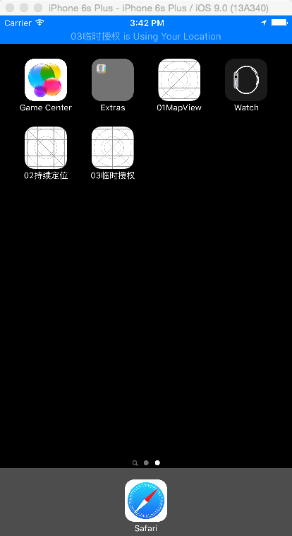
临时权限进入后台如图.png
4. 地理编码和反地理编码
#import "ViewController.h"
#import <CoreLocation/CoreLocation.h>

@implementation ViewController

- (void)viewDidLoad {
    [super viewDidLoad];
    [self encode];
    [self decode];
}

// 地理编码
- (void)encode {
    // 1. 创建一个CLGeocoder对象
    CLGeocoder *geocoder = [CLGeocoder new];
    // 2. 实现地理编码
    [geocoder geocodeAddressString:@"乌鲁木齐" completionHandler:^(NSArray<CLPlacemark *> * _Nullable placemarks, NSError * _Nullable error) {
        // 处理出错
        if (error || placemarks.count == 0) {
            NSLog(@"解析出错");
            return;
        }
        // 遍历数组
        for (CLPlacemark *placeMark in placemarks) {
            NSLog(@"latitude: %f", placeMark.location.coordinate.latitude);
            NSLog(@"longitude: %f", placeMark.location.coordinate.longitude);
            NSLog(@"name: %@", placeMark.name);
//            latitude: 43.792818
//            longitude: 87.617733
//            name: Xinjiang Urumqi
        }
    }];
}

// 反地理编码
- (void)decode {
    // 1. 创建CLGeocoder对象
    CLGeocoder *geocoder = [CLGeocoder new];
    // 2. 创建一个CLLocation对象
    CLLocation *location = [[CLLocation alloc] initWithLatitude:43.792818 longitude:87.617733];
    // 3. 反地理编码
    [geocoder reverseGeocodeLocation:location completionHandler:^(NSArray<CLPlacemark *> * _Nullable placemarks, NSError * _Nullable error) {
        // 处理出错
        if (error || placemarks.count == 0) {
            NSLog(@"解析出错");
            return;
        }
        // 遍历数组
        for (CLPlacemark *placeMark in placemarks) {
            NSLog(@"latitude: %f", placeMark.location.coordinate.latitude);
            NSLog(@"longitude: %f", placeMark.location.coordinate.longitude);
            NSLog(@"name: %@", placeMark.name);
//            latitude: 43.794040
//            longitude: 87.620584
//            name: No.37 Zhongshan Road
        }
    }];

}

@end
5. MapView使用
1). 导入Mapkit.framework
点击工程->General->Linked Frameworks and Libraries,输入MapKit,点击Add。
2). 示例
/**
 #pragma mark 1. 显示用户位置 (掌握)
 #pragma mark 2. 设置地图显示类型 (掌握)
 #pragma mark 3. 根据用户位置显示对应的大头针信息(掌握)
 #pragma mark 4. 设置以用户所在位置为中心点(掌握)
 #pragma mark 5. 获取地图显示区域改变时的中心点坐标及显示跨度 (了解)
 */

#import "ViewController.h"
#import <MapKit/MapKit.h>

@interface ViewController ()<MKMapViewDelegate>
@property (weak, nonatomic) IBOutlet MKMapView *mapView;
@property (nonatomic, strong) CLLocationManager *mgr;
@end

@implementation ViewController

- (void)viewDidLoad {
    [super viewDidLoad];

    //1. 创建位置管理器
    self.mgr = [CLLocationManager new];

    //2. 请求授权 --> plist
    if ([self.mgr respondsToSelector:@selector(requestWhenInUseAuthorization)]) {
        [self.mgr requestWhenInUseAuthorization];
    }

    //3. 设置显示用户位置
    //Tracking: 跟踪
    /**
     MKUserTrackingModeNone = 0,
     MKUserTrackingModeFollow,             定位
     MKUserTrackingModeFollowWithHeading,  定位并且显示方向
     */
    self.mapView.userTrackingMode = MKUserTrackingModeFollow;

    //4. 设置代理 --> 获取用户位置信息
    self.mapView.delegate = self;


    /**
     iOS9新增属性
     */
    //1. 设置交通状况
    self.mapView.showsTraffic = YES;

    //2. 设置指南针(默认就是YES), 屏幕旋转后会出现, 如果点击会校正方向
    self.mapView.showsCompass = YES;

    //3. 设置比例尺
    self.mapView.showsScale = YES;
}

#pragma mark 切换地图类型
- (IBAction)mapTypeChangeClick:(UISegmentedControl *)sender {
    /**
     MKMapTypeStandard = 0,    默认
     MKMapTypeSatellite,       卫星
     MKMapTypeHybrid,          混合
     MKMapTypeSatelliteFlyover NS_ENUM_AVAILABLE(10_11, 9_0), 下面两个属性, 中国区无用
     MKMapTypeHybridFlyover NS_ENUM_AVAILABLE(10_11, 9_0),
     */
    // 设置地图类型 , 一般要使用默认, 要么使用混个, 单纯的卫星图没有意义.
    switch (sender.selectedSegmentIndex) {
        case 0:
            self.mapView.mapType = MKMapTypeStandard;
            break;
        case 1:
            self.mapView.mapType = MKMapTypeSatellite;
            break;
        case 2:
            self.mapView.mapType = MKMapTypeHybrid;
            break;
        case 3:
            self.mapView.mapType = MKMapTypeSatelliteFlyover;
            break;
        case 4:
            self.mapView.mapType = MKMapTypeHybridFlyover;
            break;

        default:
            break;
    }
}

/**
 完成用户位置更新的时候 调用
 MKUserLocation : 大头针模型
 */
- (void)mapView:(MKMapView *)mapView didUpdateUserLocation:(MKUserLocation *)userLocation
{
    //需求: 显示大头针信息 --> 反地理编码实现

    //1. 创建一个CLGeocoder对象
    CLGeocoder *geocoder = [CLGeocoder new];

    //2. 实现反地理编码方法
    [geocoder reverseGeocodeLocation:userLocation.location completionHandler:^(NSArray<CLPlacemark *> * _Nullable placemarks, NSError * _Nullable error) {

        //3.1 防错处理
        if (placemarks.count == 0 || error) {
            return;
        }

        //3.2 获取对象
        CLPlacemark *placemark = placemarks.lastObject;

        //3.3 设置标题为城市信息
        userLocation.title = placemark.locality;

        //3.4 设置子标题为详细地址
        userLocation.subtitle = placemark.name;
    }];

}

#pragma mark 点击此按钮, 返回用户所在的位置
- (IBAction)backUserLocationClick:(id)sender {
    //1. 设置中心点坐标
    //self.mapView.centerCoordinate = self.mapView.userLocation.location.coordinate;

    //2. 设置范围的属性
    //2.1 获取坐标
    CLLocationCoordinate2D coordinate = self.mapView.userLocation.location.coordinate;

    //2.2 设置显示范围 --> 为了跟系统默认的跨度保持一致, 我们可以打印region的span值来获取, 然后设置即可
    //1° ~ 111KM
    MKCoordinateSpan span = MKCoordinateSpanMake(0.021252, 0.014720);

    //2.3 设置范围属性 默认没有动画
    //self.mapView.region = MKCoordinateRegionMake(coordinate, span);

    //设置范围方法 可以设置动画
    [self.mapView setRegion:MKCoordinateRegionMake(coordinate, span) animated:YES];
}

/**
 当地图显示区域发生改变后, 会调用的方法
 */
- (void)mapView:(MKMapView *)mapView regionDidChangeAnimated:(BOOL)animated
{
    //获取默认的显示大小 --> span
    NSLog(@"latitudeDelta : %f, longitudeDelta: %f", mapView.region.span.latitudeDelta, mapView.region.span.longitudeDelta);

    // latitudeDelta : 0.021252, longitudeDelta: 0.014720
    // latitudeDelta : 0.010626, longitudeDelta: 0.007360
    // latitudeDelta : 0.005313, longitudeDelta: 0.003680
}

#pragma mark 放大地图
- (IBAction)zoomInClick:(id)sender {
    //1. Delta 跨度缩小一倍
    //region : 是当前地图显示的区域
    CGFloat latitudeDelta = self.mapView.region.span.latitudeDelta * 0.5;
    CGFloat longitudeDelta = self.mapView.region.span.longitudeDelta * 0.5;

    //2. 重设region属性
    [self.mapView setRegion: MKCoordinateRegionMake(self.mapView.centerCoordinate, MKCoordinateSpanMake(latitudeDelta, longitudeDelta)) animated:YES];
}

#pragma mark 缩小地图
- (IBAction)zoomOutClick:(id)sender {
    //1. Delta 跨度放大一倍
    //region : 是当前地图显示的区域
    CGFloat latitudeDelta = self.mapView.region.span.latitudeDelta * 2;
    CGFloat longitudeDelta = self.mapView.region.span.longitudeDelta * 2;

    //2. 重设region属性
    [self.mapView setRegion: MKCoordinateRegionMake(self.mapView.region.center, MKCoordinateSpanMake(latitudeDelta, longitudeDelta)) animated:YES];
}
@end
6. 点击添加大头针
1). 新建类MyAnnotationModel,并实现协议MKAnnotation,属性从协议中拷贝,并删除readonly。
/**
 1. 导入框架 MapKit
 2. 遵守协议 MKAnnotation
 3. 设置属性 直接去协议中拷贝-->删掉readonly
 */
#import <Foundation/Foundation.h>
#import <MapKit/MapKit.h>

@interface MyAnnotationModel : NSObject<MKAnnotation>
@property (nonatomic) CLLocationCoordinate2D coordinate;
@property (nonatomic, copy, nullable) NSString *title;
@property (nonatomic, copy, nullable) NSString *subtitle;
@end
2). MapView中点击添加大头针
#import "ViewController.h"
#import <MapKit/MapKit.h>
#import "MyAnnotationModel.h"

@interface ViewController ()<MKMapViewDelegate>

@property (weak, nonatomic) IBOutlet MKMapView *mapView;

/** 位置管理器*/
@property (nonatomic, strong) CLLocationManager *mgr;

@end

@implementation ViewController

- (void)viewDidLoad {
    [super viewDidLoad];

    //1. 创建位置管理器
    self.mgr = [CLLocationManager new];

    //2. 请求授权
    if ([self.mgr respondsToSelector:@selector(requestWhenInUseAuthorization)]) {
        [self.mgr requestWhenInUseAuthorization];
    }

    //3. 跟踪用户位置
    self.mapView.userTrackingMode = MKUserTrackingModeFollow;

    //4. 设置地图的代理
    self.mapView.delegate = self;
}


#pragma mark 地图的代理方法
/**
 只要添加了大头针模型, 就会来到这个方法, 设置并返回对应的View
 */
- (MKAnnotationView *)mapView:(MKMapView *)mapView viewForAnnotation:(id<MKAnnotation>)annotation
{

    //如果返回nil, 就代表用户没有自定义的需求, 所有的View样式由系统处理
    //MKUserLocation: 系统专门显示用户位置的大头针模型
    //MyAnnotationModel: 自定义的类

    //1. 如果发现是显示用户位置的大头针模型,  就返回nil
    if ([annotation isKindOfClass:[MKUserLocation class]]) {
        return nil;
    }


    //2. 自定义大头针View --> 跟Cell的创建几乎一样
    static NSString *ID = @"annoView";

    //MKAnnotationView : 默认image属性没有赋值
    //MKPinAnnotationView : 子类是默认有View的
    MKPinAnnotationView *annoView = (MKPinAnnotationView *)[mapView dequeueReusableAnnotationViewWithIdentifier:ID];

    if (annoView == nil) {
        annoView = [[MKPinAnnotationView alloc] initWithAnnotation:annotation reuseIdentifier:ID];

        /**
         MKPinAnnotationColorRed
         MKPinAnnotationColorGreen,
         MKPinAnnotationColorPurple
         */

        //3. 设置颜色, iOS9新增
        annoView.pinTintColor = [UIColor colorWithRed:arc4random_uniform(256) / 255.0 green:arc4random_uniform(256) / 255.0  blue:arc4random_uniform(256) / 255.0  alpha:1];

        //4. 设置动画掉落
        annoView.animatesDrop = YES;

    }

    return annoView;

}


#pragma mark 点击添加大头针
- (void)touchesBegan:(NSSet<UITouch *> *)touches withEvent:(UIEvent *)event
{
    //1. 获取点击地图的点
    CGPoint point = [[touches anyObject] locationInView:self.mapView];


    //2. 将点击的点转换成经纬度
    CLLocationCoordinate2D coordinate = [self.mapView convertPoint:point toCoordinateFromView:self.mapView];

    //3. 添加大头针
    MyAnnotationModel *annotationModel = [MyAnnotationModel new];

    annotationModel.coordinate = coordinate;
    annotationModel.title = @"北京市";
    annotationModel.subtitle = @"北京市一个迷人的城市";

    [self.mapView addAnnotation:annotationModel];
}

@end
3). 自定义大头针图标
- 为自定义的大头针添加属性
/** 图像属性*/
@property (nonatomic, copy, nullable) NSString *icon;
- 在返回自定义大头针的时候为属性赋值
#pragma mark 地图的代理方法
/**
 只要添加了大头针模型, 就会来到这个方法, 设置并返回对应的View
 */
- (MKAnnotationView *)mapView:(MKMapView *)mapView viewForAnnotation:(id<MKAnnotation>)annotation
{

    //如果返回nil, 就代表用户没有自定义的需求, 所有的View样式由系统处理
    //MKUserLocation: 系统专门显示用户位置的大头针模型
    //MyAnnotationModel: 自定义的类

    //1. 如果发现是显示用户位置的大头针模型,  就返回nil
    if ([annotation isKindOfClass:[MKUserLocation class]]) {
        return nil;
    }

    //2. 自定义大头针View --> 跟Cell的创建几乎一样
    static NSString *ID = @"annoView";

    //MKAnnotationView : 默认image属性没有赋值
    //MKPinAnnotationView : 子类是默认有View的
    MKAnnotationView *annoView = [mapView dequeueReusableAnnotationViewWithIdentifier:ID];

    if (annoView == nil) {
        annoView = [[MKAnnotationView alloc] initWithAnnotation:annotation reuseIdentifier:ID];
        // 设置图像  --> MVC
        //annoView.image = [UIImage imageNamed:@"苍老师"];
    }
     // 设置图像  --> MVC
    MyAnnotationModel *myAnnotation = annotation;
    annoView.image =  [UIImage imageNamed:myAnnotation.icon];

    return nil;

}
- 在大头针图像出现之前设置图片位置
#pragma mark 此方法在添加大头针的时候就会调用, 并且, 在图像出现之前
- (void)mapView:(MKMapView *)mapView didAddAnnotationViews:(NSArray<MKAnnotationView *> *)views
{
    //NSLog(@"count: %zd",views.count);
    for (MKAnnotationView * annoView in views) {

        //0. 处理显示用户位置的大头针View, 不要增加动画
        if ([annoView.annotation isKindOfClass:[MKUserLocation class]]) {
            continue;
        }

        //1. 记录原本的位置
        CGRect endFrame = annoView.frame;

        //2. 将View的Y值改为0, 重设Frame
        annoView.frame = CGRectMake(endFrame.origin.x, 0, endFrame.size.width, endFrame.size.height);

        //3. 将位置还原, 执行动画效果
        [UIView animateWithDuration:0.25 animations:^{
            annoView.frame = endFrame;
        }];
    }
}
7. 地图导航-调用系统
#import "ViewController.h"
#import <MapKit/MapKit.h>

@interface ViewController ()
@property (weak, nonatomic) IBOutlet UITextField *destinationTF;
@end

@implementation ViewController

#pragma mark 导航按钮点击
- (IBAction)navigateClick:(id)sender {

    //1. 创建CLGeocoder对象
    CLGeocoder *geocoder = [CLGeocoder new];

    //2. 调用地理编码方法
    [geocoder geocodeAddressString:self.destinationTF.text completionHandler:^(NSArray<CLPlacemark *> * _Nullable placemarks, NSError * _Nullable error) {

        //3 防错处理
        if (placemarks.count == 0 || error) {
            NSLog(@"您输入的地址我们没找到!!!");

            return;
        }

        //遍历数组获取数据 --> 正地理编码, 可能重名, 所以数组数量大于1, 一定要给列表提示用户选择
        NSMutableArray *arr = [NSMutableArray array];

        for (CLPlacemark *pm in placemarks) {
            //4. 获取地表对象 暂取最后一个

            //5. 创建MKPlacemark对象
            MKPlacemark *mkpm = [[MKPlacemark alloc] initWithPlacemark:pm];

            //6. 创建一个MKMapItem
            MKMapItem *destItem = [[MKMapItem alloc] initWithPlacemark:mkpm];

            [arr addObject:destItem];
        }

        //7. 调用open类方法, 打开导航
        //WithItems: 传入要定位的点
        //launchOptions: 导航参数
        NSDictionary *options = @{MKLaunchOptionsDirectionsModeKey : MKLaunchOptionsDirectionsModeDriving, MKLaunchOptionsMapTypeKey : @(MKMapTypeHybrid), MKLaunchOptionsShowsTrafficKey : @(YES)};
        [MKMapItem openMapsWithItems:arr launchOptions:nil];
    }];
}
@end
8. 地图导航-自己画线
#import "ViewController.h"
#import <MapKit/MapKit.h>

@interface ViewController ()<MKMapViewDelegate>

@property (weak, nonatomic) IBOutlet MKMapView *mapView;

/** 位置管理器--> 要定位必须用这个属性*/
@property (nonatomic, strong) CLLocationManager *mgr;

@end

/**
 如果是地图画线, 无法在模拟器中运行 --> iOS8以后无法在模拟器中运行
 */

@implementation ViewController

- (void)viewDidLoad {
    [super viewDidLoad];

    // 创建位置管理器并授权
    self.mgr = [CLLocationManager new];
    if ([UIDevice currentDevice].systemVersion.floatValue >= 8.0) {
        [self.mgr requestWhenInUseAuthorization];
    }

    // 设置代理
    self.mapView.delegate = self;

}

#pragma mark 导航按钮点击
- (IBAction)navigateClick:(id)sender {

    // 回收键盘
    [self.view endEditing:YES];

    //1. 创建CLGeocoder对象
    CLGeocoder *geocoder = [CLGeocoder new];

    //2. 调用地理编码方法
    [geocoder geocodeAddressString:"西山" completionHandler:^(NSArray<CLPlacemark *> * _Nullable placemarks, NSError * _Nullable error) {

        //3 防错处理
        if (placemarks.count == 0 || error) {
            return;
        }

        //遍历数组获取数据 --> 正地理编码, 可能重名, 所以数组数量大于1, 一定要给列表提示用户选择

        //4. 获取地表对象 暂取最后一个
        CLPlacemark *pm = placemarks.lastObject;

        //5. 创建MKPlacemark对象
        MKPlacemark *mkpm = [[MKPlacemark alloc] initWithPlacemark:pm];

        //6.1 创建一个终点MKMapItem
        MKMapItem *destinationItem = [[MKMapItem alloc] initWithPlacemark:mkpm];

        //6.2 创建一个起点MKMapItem
        MKMapItem *souceItem = [MKMapItem mapItemForCurrentLocation];

        //7. 创建一个方向请求对象 --> 相当于拼接网址 --> 需要传入参数: 起点和终点
        MKDirectionsRequest *request = [MKDirectionsRequest new];

        //7.1 设置终点
        request.destination = destinationItem;

        //7.2 设置起点
        request.source = souceItem;


        //8. 创建方向对象 --> 创建一个请求对象
        MKDirections *direction = [[MKDirections alloc] initWithRequest:request];

        //9. 计算路径 --> 处理网络请求的结果
        [direction calculateDirectionsWithCompletionHandler:^(MKDirectionsResponse * _Nullable response, NSError * _Nullable error) {

            //10.1 防错处理
            if (response.routes.count == 0 || error) {
                NSLog(@"没有找到对应的路线");
                return ;
            }
            //10.2 遍历数组, 获取数据
            //MKRoute : 路线对象
            for (MKRoute *route in response.routes) {

                //polyline : 多段线

                //11. 获取折线信息
                MKPolyline *polyline = route.polyline;

                //12. 添加到地图上
                //Overlay : 遮盖物
                [self.mapView addOverlay:polyline];
            }
        }];
    }];
}

#pragma mark 如果添加了遮盖物, 就需要调用此方法, 来设置渲染
- (MKOverlayRenderer *)mapView:(MKMapView *)mapView rendererForOverlay:(id<MKOverlay>)overlay
{
    //1. 创建一个折线渲染物对象
    MKPolylineRenderer *polyline = [[MKPolylineRenderer alloc] initWithOverlay:overlay];

    polyline.fillColor = [UIColor redColor];
    //2. 设置线条颜色 --> 必须设置, 否则看不见
//    polyline.strokeColor = [UIColor blueColor];

    //3. 设置线条宽度
    polyline.lineWidth = 10;
    return polyline;
}
@end